Point of interest nearby Anixter
Coronavirus disease (COVID-19) Situation
confirmed cases
1059893
deaths
8727
Panama
Point of interest nearby Anixter
Anixter
Calle H Norte, David Panama
contacts phone
:
+507
Latitude:
8.4391643
, Longitude:
-82.428155
read more
nearest Point of interest
121 m
Bio Materiales
David
Point of interest
read more
275 m
Publisign
Avenida 3a Oeste, David
Point of interest
read more
391 m
Multiservicios JEF
David
Point of interest
read more
467 m
Diócesis de David, Obispado de David
Avenida Obaldía, David
Point of interest
read more
495 m
Stereo Planet 100.9
Avenida Obaldía, David
Point of interest
read more
498 m
CORPRENSA
David
Point of interest
read more
502 m
Barberia Gent's
David
Point of interest
read more
514 m
Electritel / Atel
David
Point of interest
read more
544 m
Kala Digital Corp.
Calle H Norte, David
Point of interest
read more
577 m
Club Rotario de David
Avenida Belisario Porras, David
Point of interest
read more
580 m
Credi-Hogar
Avenida Obaldía, David
Point of interest
read more
617 m
Micro Technology
Avenida 6ta Oeste y Calle N Norte, David
Point of interest
read more
682 m
BEAT LIFE PANAMA
Avenida Francisco Clark, David
Point of interest
read more
767 m
La lucila
David
Point of interest
read more
839 m
Panachif
David
Point of interest
read more
878 m
Go Rentals, S.A.
Carretera Panamericana, David
Point of interest
read more
893 m
DHL Oficina David
Chiriquí
Point of interest
read more
898 m
Fotocopias Edif. Don Chalo
Calle E Norte, David
Point of interest
read more
900 m
BoxShop
Avenida Central, David
Point of interest
read more
917 m
Torneria Samy
Manuel Quintero Villareal, David
Point of interest
read more
983 m
Air Panamá
David
Point of interest
read more
986 m
OBSE Panamá
Calle C Norte, David
Point of interest
read more
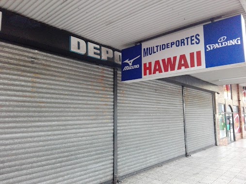
1.069 km
multideportes Hawaii
Avenida Bolívar, David
Point of interest
read more
1.093 km
Radio Taxi Cristal
David
Point of interest
read more
1.186 km
Wilma Bienes Raices
Avenida Francisco Clark, David
Point of interest
read more
📑
all categories
Accounting
Administrative area level 1
Administrative area level 2
Airport
Amusement park
Aquarium
Art gallery
Atm
Bakery
Bank
Bar
Beauty salon
Bicycle store
Book store
Bowling alley
Bus station
Cafe
Campground
Car dealer
Car rental
Car repair
Car wash
Casino
Cemetery
Church
City hall
Clothing store
Colloquial area
Convenience store
Courthouse
Dentist
Department store
Doctor
Electrician
Electronics store
Embassy
Finance
Fire station
Florist
Food
Funeral home
Furniture store
Gas station
General contractor
Grocery or supermarket
Gym
Hair care
Hardware store
Health
Hindu Temple
Home goods store
Hospital
Insurance agency
Jewelry store
Laundry
Lawyer
Library
Liquor store
Local government office
Locality
Locksmith
Lodging
Meal delivery
Meal takeaway
Mosque
Movie theater
Moving company
Museum
Natural feature
Neighborhood
Night club
Painter
Park
Parking
Pet store
Pharmacy
Physiotherapist
Place of worship
Plumber
Point of interest
Police
Post office
Premise
Real estate agency
Restaurant
Roofing contractor
Route
Rv park, camping
School
Shoe store
Shopping mall
Spa
Stadium
Storage
Store
Subpremise
Subway station
Supermarket
Synagogue
Taxi stand
Train station
Transit station
Travel agency
University
Veterinary care
Zoo
administrative area level 3
sublocality level 1
↑