places in Las Tablas
Panama
Las Tablas
Las Tablas
Administrative Region:
Los Santos
population:
8 945
calling code:
+507-9
postcode:
070201
Location on the map of Panama
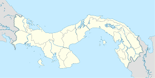
Las Tablas
Bus station
Calle Ramon Mora
Paseo Carlos Lopez, Las Tablas
Bus station
read more
Villarreales
Las Tablas
Bus station
read more
Praga
Las Tablas
Bus station
read more
CSS
Las Tablas
Bus station
read more
Piquera de Buses
Via Hacia El Carate
Bus station
read more
Nvo. Mexico
Carretera Nacional 2, Las Tablas
Bus station
read more
Delta
Carretera Nacional 2, Las Tablas
Bus station
read more
Vía Doctor Belisario Porras
Las Tablas
Bus station
read more
Cochez
Las Tablas
Bus station
read more
Cooesan
Las Tablas
Bus station
read more
Hospital G.D.L.
Paseo Carlos Lopez, Las Tablas
Bus station
read more
Mega Centro
Carretera Nacional 2, Las Tablas
Bus station
read more
COOSVETRAS
Paseo Carlos Lopez, Las Tablas
Bus station
read more
CADI
Las Tablas
Bus station
read more
Super Carnes
Las Tablas
Bus station
read more
Cafe
Café El Poderoso
Calle De Estudiante, Las Tablas
Cafe
read more
La Esquina De Los Dulces
Vía Doctor Belisario Porras, Las Tablas
Cafe
read more
Empanadas y Frutas Daniel's
Panama
Cafe
read more
Refresqueria Sunset
Calle De Estudiante, Las Tablas
Cafe
read more
Refresquería Mamma Pina
Las Tablas
Cafe
read more
La Paulina Café
Avenida Pablo Arosemena, Las Tablas
Cafe
read more
Casino
Winner Bar & Casino
Avenue Rogelio Gaez, Las Tablas
Casino
read more
Dentist
Clínica Rohrmoser Las Tablas
Panama, Vía Doctor Belisario Porras
Dentist
read more
Dr Hermann
Las Tablas
Dentist
read more
DentiAzuero
Las Tablas
Dentist
read more
Clínica Guadalupana
Las Tablas
Dentist
read more
Electronics store
Local Coop. Gladys B. de Ducasa, R.L.
Las Tablas
Electronics store
read more
Web Zone
Las Tablas
Electronics store
read more
Autentica Electronic
Paseo Carlos Lopez, Las Tablas
Electronics store
read more
grupomega las tablas
esquina edificio, grupomega, Calle Amado de Jesus Barrios, Las Tablas
Electronics store
read more
📑
Las Tablas all categories
Atm
Bakery
Bank
Bar
Beauty salon
Bicycle store
Bus station
Cafe
Car repair
Car wash
Casino
Cemetery
Church
Clothing store
Dentist
Doctor
Electronics store
Finance
Fire station
Florist
Funeral home
Furniture store
Gas station
Grocery or supermarket
Gym
Hair care
Hardware store
Health
Home goods store
Hospital
Insurance agency
Laundry
Lawyer
Library
Local government office
Locality
Lodging
Moving company
Museum
Natural feature
Neighborhood
Night club
Park
Pharmacy
Place of worship
Point of interest
Police
Post office
Premise
Restaurant
School
Shopping mall
Stadium
Store
Supermarket
University
Veterinary care
↑